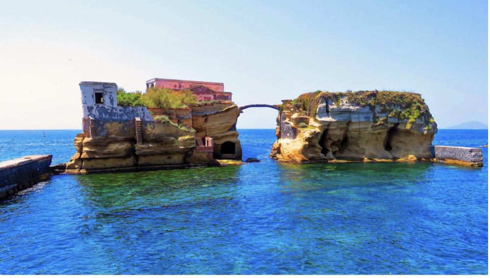
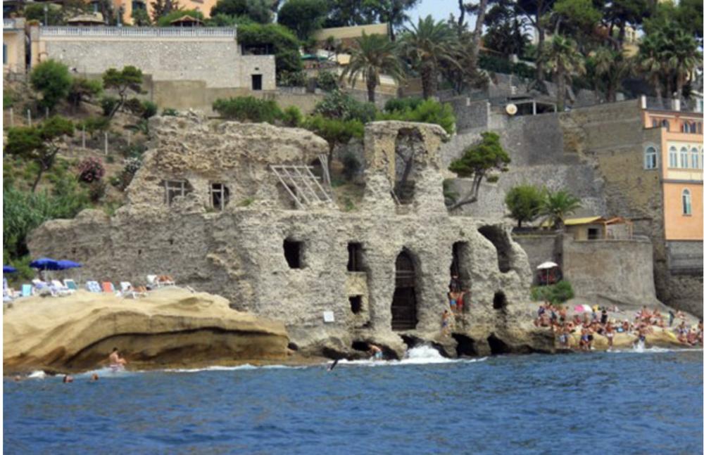
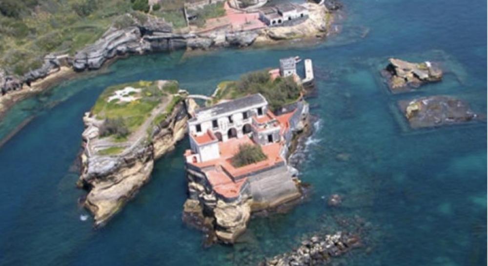
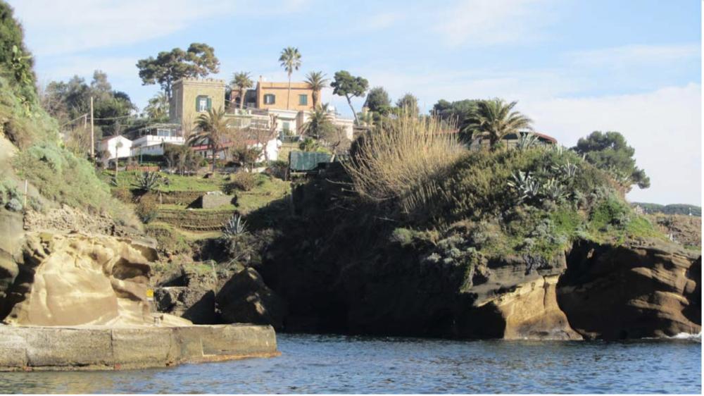
Il Parco Sommerso di Gaiola prende il nome dai due isolotti che sorgono a pochi metri di distanza dalla costa di Posillipo, nel settore nord occidentale del Golfo di Napoli. Con una superficie di appena 41,6 ettari, si estende dal pittoresco Borgo di Marechiaro alla suggestiva Baia di Trentaremi racchiudendo verso il largo parte del grande banco roccioso della Cavallara. Deve la sua particolarità alla fusione tra aspetti vulcanologici, biologici e storico-archeologici, il tutto nella cornice di un paesaggio costiero tra i più suggestivi del Golfo. I costoni rocciosi e le alte falesie di Tufo Giallo Napoletano, rimodellate dal mare e dal vento, ammantate dai colori della macchia mediterranea, regalano ancora oggi scorci di rara bellezza che da sempre hanno incantato i popoli che qui si sono succeduti. Proprio per la bellezza del paesaggio, infatti, a partire da I sec a.C. su questa costa si insediarono suntuose ville dell′aristocrazia romana, la più importante delle quali fu quella del Pausilypon (luogo dove finiscono i dolori) che, eretta da Publio Vedio Pollione e divenuta alla sua morte (15 a.C.) villa Imperiale, occupava gran parte della fascia costiera dell′attuale Parco. Resti di ville marittime, maestose cave di tufo, approdi, ninfei e peschiere sono oggi visibili lungo la costa sopra e sotto la superficie del mare, a causa del fenomeno vulcano-tettonico di lento sollevamento e abbassamento della crosta terreste denominato bradisismo. La vita marina ha poi fatto il resto. L′estrema complessità geomorfologica dei fondali e la favorevole circolazione delle correnti marine, ha infatti permesso l′insediamento in pochi ettari di mare di una ricca e variegata comunità biologica che oggi riempie di vita e colori ciò che la storia della terra e quella dell′uomo hanno creato. Così mentre polpi, saraghi, donzelle e nuvole di guarracini si aggirano tra gorgonie ed antiche vestigia, una murena resta in agguato proprio tra i mattoni consumati dal tempo di un antico murenario romano...
The Submerged Park of Gaiola takes its name from the two islets that rise a few meters away from the coast of Posillipo, in the north-western sector of the Gulf of Naples. With an area of just 41.6 hectares, it extends from the picturesque Borgo di Marechiaro to the suggestive Bay of Trentaremi, enclosing towards the broad part of the large rocky bank of the Cavallara. It owes its particularity to the fusion of volcanological, biological and historical-archaeological aspects, all in the frame of a coastal landscape among the most evocative of the Gulf. The rocky ridges and the high cliffs of Neapolitan Yellow Tufo, remodeled by the sea and the wind, cloaked in the colors of the Mediterranean scrub, still offer glimpses of rare beauty that have always enchanted the peoples who have followed one another here. Precisely for the beauty of the landscape, in fact, starting from the 1st century BC. sumptuous villas of the Roman aristocracy settled on this coast, the most important of which was that of Pausilypon (the place where pain ends) which, built by Publio Vedio Pollione and became Imperial villa at his death (15 BC), occupied a large part of the coastal strip of the current Park. Remains of maritime villas, majestic tuff quarries, landings, nymphaeums and fish ponds are today visible along the coast above and below the sea surface, due to the volcano-tectonic phenomenon of slow lifting and lowering of the earth′s crust called bradyseism. Marine life then did the rest. The extreme geomorphological complexity of the seabed and the favorable circulation of marine currents, has in fact allowed the settlement in a few hectares of sea of a rich and varied biological community that today fills with life and colors what the history of the earth and that of man have created. So while octopuses, bream, damsels and clouds of guarracini wander among gorgonians and ancient remains, a moray remains lurking right among the bricks worn by the time of an ancient Roman masonry...

